|
| Ojo Jarido Spring |
This weekend, I needed some time to myself. So throughout the week, I began planning what shenanigans I should get myself into. First I thought, perhaps I'll go south and explore some slot canyons in the southern Gila. Then I had the thought of visiting pueblitos and arches south of Navajo Lake. Then I stumbled upon the idea of visiting the vast region north of Cabezon, but southwest of Cuba.
 |
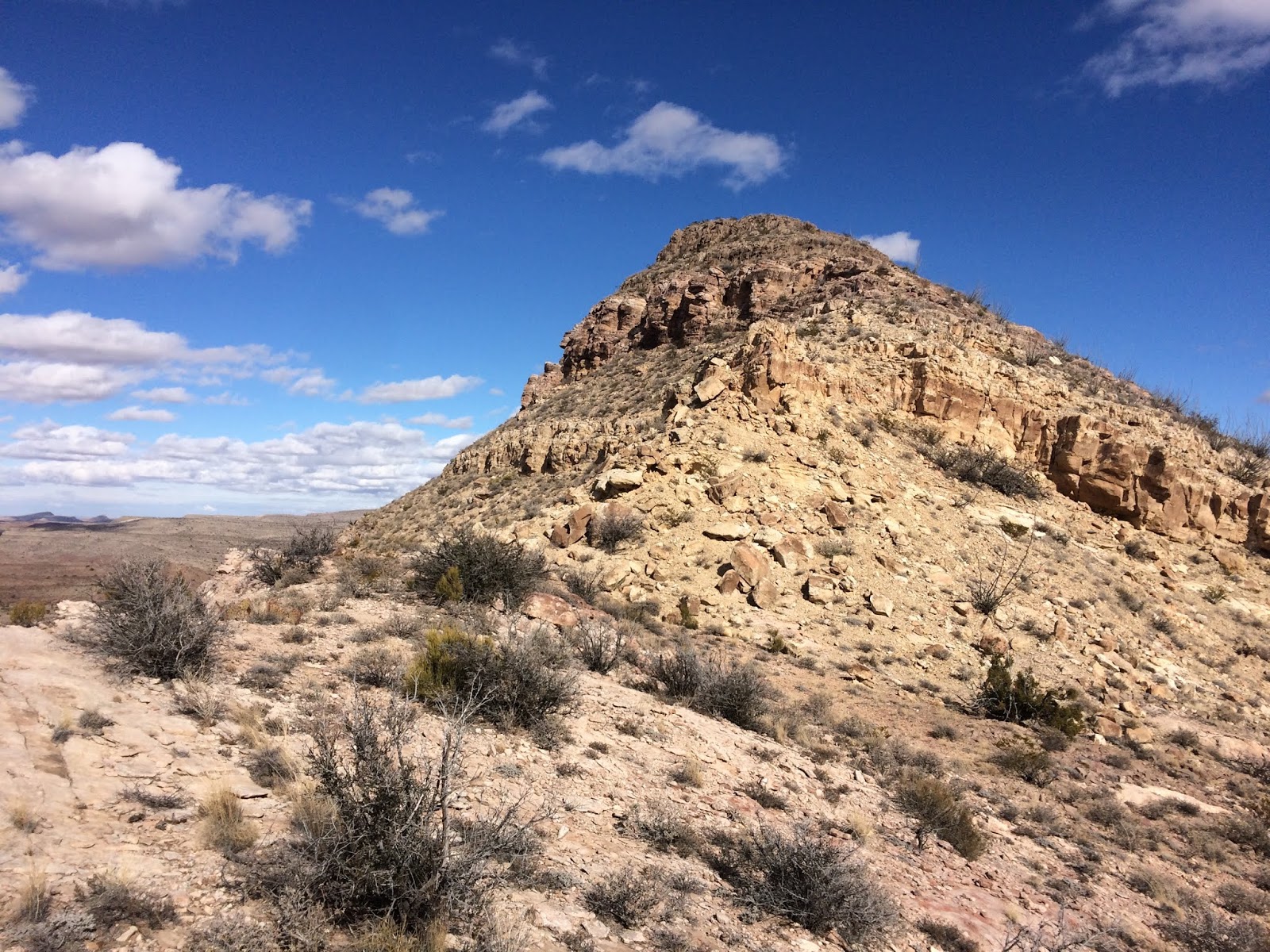
| Cañon Jarido in the morning twilight |
I left work on Friday with a plan. Drive up north to Cañon Jarido, find a nice spot to park, roll out the sleeping bag, and sleep in my car. As suspected, I had a difficult time finding the correct road off of the main dirt road. I unsuccessfully attempted three roads that went toward my destination, but all quickly deteriorated to a condition I didn't feel comfortable driving in, at least at night. After a fourth attempt, I found the correct road, which, albeit not great, was better than the others. I laid in my sleeping bag with the wind blowing against the car to lull me to sleep.
 |
| Beautiful sunrise! |
 |
| Fenced off and healthy spring |
Woke up Saturday morning to a chilly 24 degrees outside. Coldest temps I've camped in yet! It was manageable though, and well worth it to wake up in such a beautiful location! I was between low-rising hills to the south and steep sandstone walls to the north. I saw my destination just ahead of my car, so I opted to warm myself up by going for a quick stroll before breakfast. I found a nearby geocache and then strolled over to a large arching "cave". Inside this cave exists something I have never seen before...a Navajo Star Ceiling.
 |
| X's on the ceiling represent stars |
 |
| Faint stars on the ceiling roughly 50 feet up |
On the roof of this cave exist many small x's. These x's represent stars, but the meaning behind them is somewhat lost. Some believe the stars represent specific constellations that are significant to Navajo and their religion, while others believe the stars are random and meant to simply signify the protection given by the stars (again, a Navajo belief). However, I am no archaeologist, and I simply admire these features with awe and appreciation. Nearby, the remnants of an old homestead remain, with a small nook carved into a boulder that was one of its walls. Was this nook for storage? Fire? I'm not sure, but it was interesting to see.
 |
| Nearby homestead ruin |
 |
| Carved into the boulder on edge of ruin |
I explored the area further after this, where I found one site that I suspect is rubble of an ancient structure, and lots of pot sherds in certain pockets. I simply admired it, leaving everything where and as it was. The mesa tops were so beautiful with the entire edges being a sandstone wonderland. After some more wandering, I headed back to the car for my second hike of the day over near La Ventana Mesa.
 |
| Mesa top wandering |
 |
| Another seep spring site |
I stepped out of the car at the parking area for the Continental Divide Trail, hoping the wind wasn't as bad as the uniform angle of the grasses implied. It was. I put on an extra layer and just started hiking south on the CDT. The hike in wasn't terrible, as I was hiking with the wind. However, I was not oblivious to the fact that the hike back (into the wind) was going to be a little less than enjoyable. En route to Jones Canyon, the CDT is very easy to follow. A combination of well built cairns and white-topped posts line the trail, sometimes as close as 20 feet apart from one another. As you near the rising western slopes of La Ventana Mesa, you begin to encounter more sandstone features, which always enrich any hiking experience in my book.
 |
| Jones Canyon Spring and alcove |
It's hard to miss the Jones Canyon spring. As you hike the CDT and pass the small side canyon that branches off the main Jones Canyon, there is a big and obvious sign pointing the way, distance, and providing the knowledge that the spring water must be treated. From this point if you look north you can spot the large homestead ruins. Staying in the arroyo will bring you right to the spring, which was solid ice on my visit. Above the spring is a large overhung alcove, providing bountiful shade opportunity on sunny days. The main canyon south of this spring is where I'm lead to believe one may find petroglyphs and pueblo ruins, but I was unable to spot them on my exploration as I left the mesa later.
 |
| Homestead ruin |
 |
| Slickrock hiking on the CDT |
After visiting the impressive homestead ruins, I continued up the CDT to where it follows the spine of La Ventana Mesa, making side trips here and there to locate geocaches.The terminus of my hike was a location on the north end of La Ventana Mesa, just less than three quarters of a mile off trail. This required navigating through one cliff band, which I found an easy down climb location to get through. After this it was wandering through beautiful juniper dotted hills, skirting an occasional sandstone drainage. I arrived at my destination shortly thereafter...a point with spectacular views in ALL directions! The Nacimiento Mountains to the northeast, the Jemez Mountains and Red Mesa to the east and southeast, and incredible views of the whole stretch of La Ventana Mesa from north to south. Just below this viewpoint lie the bare bones of an old Navajo hogan. The walls still stood for a couple feet above the ground but most of the structure has deteriorated and vanished. Some large, blank, pot sherds remain within the boundaries of the hogan. What a place to live! I couldn't help but ponder if whoever inhabited this hogan knew of a nearby spring or if they hiked down to the Rio Puerco for their water. Though I suppose it would've been easier to hike back to Jones Canyon Spring than to hike all the way down to the Rio Puerco.
 |
| Southern views of La Ventana Mesa |
 |
| Northern views of La Ventana Mesa and the Nacimiento Mountains |
 |
| Faintly visible hogan site |
The hike back was beautiful, with views of Mesa Portales to the north most of the way. The wind was less than amicable. They were probably a steady 20+ mph in the lower and more open areas, and gusting close to 50 mph along edges of Jones Canyon. I wandered the cliff bands throughout the canyon, keeping my eyes peeled for any signs of historic visitation, but my untrained eyes didn't catch anything. Surely, the penetrating winds had no part in the short duration of my visit.
 |
| Parking/camping spot out in the Empedrado/La Lena WSA region |
I arrived back to my car, happy to find windless shelter within its confines. I drove back to 550 and then south, getting off the highway on the road to Cabezon and San Luis. I could have just driven BLM 1102 from near my CDT hike all the way south, but didn't want to risk any lost time by coming across any washouts or general conditions that I couldn't navigate. So I drove up the southern end of 1102 to a jeep road where I drove west into the Empedrado WSA. I camped off the road in my car again, listening to the brutal and relentless winds outside. As I was reading in my car, I couldn't help but think "I should've brought a sudoku book or something!" That's the only downside of camping at this time of year, where the sun is set by 5 o'clock and the winds knock the wind chill down into the single digits. Eventually I bundled up, curled up in my sleeping bag, and slept the night away.
 |
| Badlands below unnamed mesa |
 |
| Unnamed mesa with a prominent "bow" like feature |
The next morning, I woke up to see a line of cows making their way to the large man-made pond just north of me. The first spot they came to appeared to be solid ice, so they wandered around until they found a spot thin enough to break and drink from. It was a cozy 17 degrees! Now THAT is my current coldest camping temperature. Luckily, sleeping with three layers of pants, four layers of shirts, a sleeping bag, a blanket inside the sleeping bag, and another blanket on top of the sleeping bag were all enough to keep me warm enough to sleep through the night, despite the frozen condensation on a few of the windows.
 |
| Neat erosional features |
 |
| Little ruin structure |
After eating a quick breakfast, the sun had warmed things up a bit and I was ready to get going. That day, my plan was to visit several geocaches in the region in order to get a starting point of exploration. First I hiked northwest toward the base of a large unnamed mesa that lies just north of the Empedrado wash. There were some spectacular badlands with varying colors of hoodoos beneath the towering mesa walls. After a short hike along the base of this mesa (which prompted me to post a hike with the Mountain Club to come back and explore the mesa proper), I hiked cross country a few miles south to visit some more geocaches. These other two were placed in locations that highlighted some of my favorite aspects of the desert: sandstone canyons and limitless views. This visit farther south definitely piqued my interest and I cannot wait to get back out here to wander these sandstone drainages further! I came up one short slickrock canyon en route, finding one small ruin site, and came to the prime destination which was a pocket of sandstone domes that were reminiscent of Moab-area landscapes.
 |
| Shallow slickrock canyon |
 |
| Downstream view of little slickrock tributary |
Leaving this sandstone wonderland, I headed back east to reconnect with the CDT. I traveled along the edge of Mesa San Luis to get there, where more of that beautiful sandstone and badland-studded mesa country was just beckoning! As I neared the CDT, I dropped off the top of the mesa to wander some of the drainages. I found one that had a short slot section with big dryfall that would've required a rappel to descend directly. Immediately after, I found another with a short arch that crossed the narrow sandstone drainage. Beyond this I hiked below some beautifully eroded cliffs and boulders, climbing up there to reconnect with the CDT. From the CDT travels north through a deep wash that drops down off the mesa to the south.
 |
| Sandstone dome in a sandstone wonderland! |
The short stretch following this was another section that ignited a fervor for exploration! So much erosion, so much sandstone, so much color! There is a reason I consider myself a desert rat...this is by far the greatest landscape of all, and if you look around, there isn't another soul here to spoil the silence and the views. After exiting the last of the sandstone-decorated wash, the trail travels cross country toward Empedrado Wash. At a certain point I left the trail again to head back toward the car, but visiting one last pocket of white sandstone country before leaving. I saw what looked like a short slot leading into the white bluffs, so felt I must certainly visit it to see if my eyes were deceiving me or not.
 |
| Views of Cabezon, Cuate, Santa Clara, and Guadalupe from my lunch spot |
Upon reaching the bluffs, I found that my first hopeful slot was not a slot at all, but merely a short dryfall that was recessed into the cliff band. My second hopeful slot, however, was an actual slot, probably only 50 feet long and with a couple of big drops to negotiate getting in and out of it. It was a lovely way to end the 8.5 mile long loop through this under-appreciated country.
 |
| Small arch in a tribuary on the edge of Mesa San Luis |
To top off the day, I wanted to hide a geocache I've intended to hide for months. On my way out, I stopped somewhere along BLM 1102 to hike down into the main arroyo that follows the road all the way back to CR 279. There is a lovely tributary of this arroyo that passes through a short slot-like section, complete with slumps you must travel beneath, a small bridge you travel beneath near the beginning, and a double bridge near the exit of the tributary. It is short, but it is a lovely surprise hidden right off the road! Managed to neglect photos of this spot this time around. After revisiting this area, hiding my geocache, and hiking back to the car, I left the region feeling so satiated, though my ironic thirst for the desert was only just beginning to feel quenched.
 |
| Small white sandstone slot |
 |
| Peering out of slot |
So if you stuck around all the way to the end, congratulations! I don't have anything to award you, but hopefully you didn't feel like it was a total waste of your time, and hopefully it inspired a desire for you to look more into this wonderful landscape north and northwest of Cabezon Peak. As always, don't just take my word for how unique and worthwhile this region is...get out and find out for yourself!