Showing posts with label Socorro. Show all posts

Tuesday, February 26, 2019

Ridgewalking Along Loma de las Cañas

Although this hike was done a couple months ago (and I have some catching up to do), I still feel like it is deserving of acknowledgement in a post of its own.
Loma de las Cañas

I had been toying with the idea of posting this hike with the Mountain Club to take some folks out and go exploring. However, I'm always facing inner conflict on whether I want to explore solo or with a group. I ended up posting it on Friday as a last minute hike for Sunday. By the end of the day, no one had signed up, so I decided to nix it and do it Saturday solo. It was likely the best option, as the experience was utterly delightful!! ...and the weather for Sunday looked to be less than friendly.
First pour-off to get around

The day started out with negative potential. On a familiar stretch of road near my home in Los Lunas, I ended up getting pulled over for speeding. However, the officer who pulled me over was rather friendly and I was let off with a warning. So off to coffee, gas, and breakfast burritos I went! By the time I turned onto the Quebradas Backcountry Byway, just east of Soccoro, I was flying high. The sun was casting beautiful shadows among the hills, my burrito was excitingly delicious, and when my mouth wasn't full of that tortilla-wrapped breakfast medley, I was singing at the top of my lungs to Lady Gaga. Feel free to judge.
Beautiful sandstone bedrock

Rippled sandstone

I arrived at the parking area, got my stuff together, and headed east up Arroyo del Tajo. Right away I encountered a ten foot overhung drop that needed to be climbed around. Found a fun way up that avoided the brush on the side. Continued up the canyon and was enthralled by the grey limestone bedrock, red, yellow, and orange sandstone, and the beautiful skyline of the Loma de las Cañas ridge off to the southeast.
Peek at one of the peaks along the ridge

Farther up the arroyo, I took a right turn at a fork, continuing toward the ridge. Just beyond this fork, there was a short section of canyon where it narrowed into a red sandstone corridor. It was an odd sight, but a gorgeous one nonetheless! Farther still, I encountered spring water. A healthy spring, with its fair share of ice in the vicinity, was releasing water. I appreciated it for a moment and kept hiking. Soon enough, I came across an old homestead ruin with walls that stand surprisingly tall! Just beyond that, an old corral exists, and farther still is a short but dramatic little box canyon. The box ends in a 40 foot tiered pour-off. A steep trail heads up the north side of the canyon, but with care one can scale the pour-off.
Narrow section of canyon

Spring seeping out of the ground here

Beautiful homestead site
Collapsed ceiling beams

Just above this box is where I began my ascent of the ridgeline, which was directly south of me now. It was about two miles to this point. I came up the northeast side of the first peak along the ridgeline. This looked like an intimidating peak from the west, with a potentially craggy summit cap. However, a little routefinding was all that was needed to tag the peak. The wind had picked up a little, so I took a short break on the west side of the peak and finished off what little was left of my burrito.
Old corral

Looking into box canyon from the top

Looking towards first peak along ridge

From here the story is mostly the same for each peak along the ridge. I hiked down off the peak, found a way onto the next peak (staying true to the ridge when possible), sometimes getting into scrambling, and then repeating the steps toward the next peak. On the southern end of the ridge, there was a bit of steep rock between the last two peaks. Getting onto the last peak I managed to find a easy 3rd class route that likely could've been bypassed. Getting off the peak was a more interesting endeavor. The threat of getting cliffed out on already steep terrain is very real all along the western edge of the ridgeline. Routes I had originally thought to work, when viewed later were verified to have cliffed out. Luckily, I found an incredibly steep zig-zagging route down through the various bands. It was slow going since there was a lot of loose rock, but it went. It was quite fun!
Looking at second peak from first peak

Looking toward the Magdalenas with other peaks near Socorro visible

Below cliff band near first peak

Looking back at first peak from second

From this point, I took an arroyo that trended northwest until it connected to a larger arroyo that I knew would run into the road. Sure enough, it ended up at the road only a half mile from the car. I trotted back toward the car, very happy at the fun-filled traverse that I have always wanted to do since my first visits out to the Quebradas. All in all, the loop was between 5 and 6 miles.


I know the story started off with a lot of potential and excitement which then sort of became more vague as it went on. I started to write this just a few days after the hike, but neglected to finish it. I finished it a couple months later. So hopefully the pictures make up for the lack of power in words, though pictures never do these places justice either. Hope you all enjoyed this recount, but as always, don't take my word for it...get out and see it for yourself!
Ocotillo

Looking at southern end of ridgeline from the west

Beautiful colors in the sandstone

Looking back at the ridgeline from near the arroyo junction

Sunday, December 23, 2018

Strolling with Purpose in Arroyo del Tajo

Last weekend I did a couple of mellow hikes in the Socorro area, revisiting the beautiful San Lorenzo Canyon and then exploring Arroyo del Tajo for the first time. I have been aware of the short box/slot canyon in Arroyo del Tajo for many years, but just hadn't taken the time to visit it. I'm glad to have finally seen its beauty for myself!
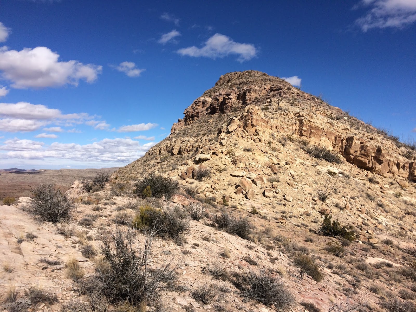
These ridges get split by these arroyos
I met my dad in the morning and we, along with the dogs, headed out, leaving Los Lunas probably around 8 in the morning after a stop for a breakfast burrito and gas top off. Southward we went, passing the pecan orchards outside of Belen, the Sevilleta and Bernardo Refuges, exiting at Escondida toward Escondida Lake. Lake is a rather aspirational term, but it is a beautiful oasis in an otherwise barren desert.
Nice long millipede
Our plan was to head south on a road just west of the Quebradas and venture to the box section from the west, visiting some pictographs in the process. We followed the "road" for as much as we could, but recent heavy rains have washed out many sections that pass through arroyos, and there was still an exceptional amount of mud. We ultimately reached a muddy stretch where the end was not in sight, so we called it and ventured around to the eastern approach, off of the Quebradas Backcountry Byway. En route I spotted my first desert tortoise!
Desert tortoise! He just made it across the road :)

If you're a lover of the desert like myself, you will definitely appreciate the views of the rugged Quebradas. A topographical delight painted with splashes of creosote and ocotilla, this region hides many treasures for those willing to wander and find them.
Arroyo near the parking area
Dad and dogs heading toward canyon
When we arrived at our parking spot, the dogs hopped out excitedly, happily trotting around this foreign landscape, smelling everything new. We ventured westward, admiring the rock formations and fossils, slowly heading downhill toward the ridge that the arroyo cuts through, creating the dramatic box. I expected to see some snakes out here, as it was a warm August day, but the only visible life were some lizards, beetles, and gargantuan tarantula hawk wasps.
Walls start rising
Dogs are loving it out here

The winding arroyo was a pleasant and modest hike, with nearly no notable elevation gain in either direction, until you enter the jewel of the arroyo that is. As you round the last couple corners, the rock starts to rise noticeably and the destination becomes obvious.
Trek peering down the first short drop

As soon as you reach the first narrow spot there is a small drop, down which our dogs skittered their way. Then it turned into more of a gorge, with dramatic walls over a hundred feet tall. You stroll through a few corners, and things start to drop again. My dad hopped over a pool and into wet sand that sank down a foot or so. Juniper (the white dog) followed suit, but she slipped into the pool and quickly ran out. The other dog, Trek, went up and over, down some more interesting terrain.
Dad in the deeper part of the canyon
Dogs in narrower section

Shortly thereafter, we were at the exit of the canyon, which terminated in another drop of about 15-20 feet. We opted to have lunch here before turning around. If you continue downstream, there is purportedly a small display of pictographs. While I would love to see that, it shall have to wait until another day, as rain clouds were starting to build.
Slot-ish tributary. Interesting, but far too thick with brush
Peering back into the open, but deep gorge

As we headed back upstream, I found a geocache that is in the area, the dogs opted to soak in all of the shallow pools in the canyon, and we found a surprisingly large beetle. We also located an old homestead ruin, one of many in the Quebradas. Everytime I find these ruins out here, I can't help but wonder what it must have been like to try to homestead this area. A harsh living it must have been.
Rare to see beetles this big...at least in my experience
Old Homestead ruin

The rest of the hike back was uneventful. Warm, but with welcome shade from the clouds attempting to spit rain. We got back to the car and headed back out toward civilization. This is such a lovely and quiet region, with surprises hiding around every corner. I've been to the Quebradas multiple times since this visit, and I am blown away by the things hiding out here every time.
Teasing monsoonal skies

But as always...don't just take my word for it. Get out and find out for yourself!