|
| Beautiful stretch deep within Big Canyon |
This last weekend satisfied a desire to visit a place that's been on my to-do list and on my mind for years! It sits up in a region just north of Gallina, NM, a region of the state that is loaded with slot canyons, with most of them being technical. The goal: Big Canyon Slot.
 |
| Allie & Patrick at one of the early alabaster downclimbs |
While most of the slot canyons in New Mexico are relatively short, this canyon is special in that is is roughly 3 miles from its beginning up on French Mesa to its exit down along the Rio Gallina. It is not a genuine slot for that entire length, but it has many slot sections, and the best is saved for last, becoming one of the most beautiful slots I've seen in this state in its last half mile.
 |
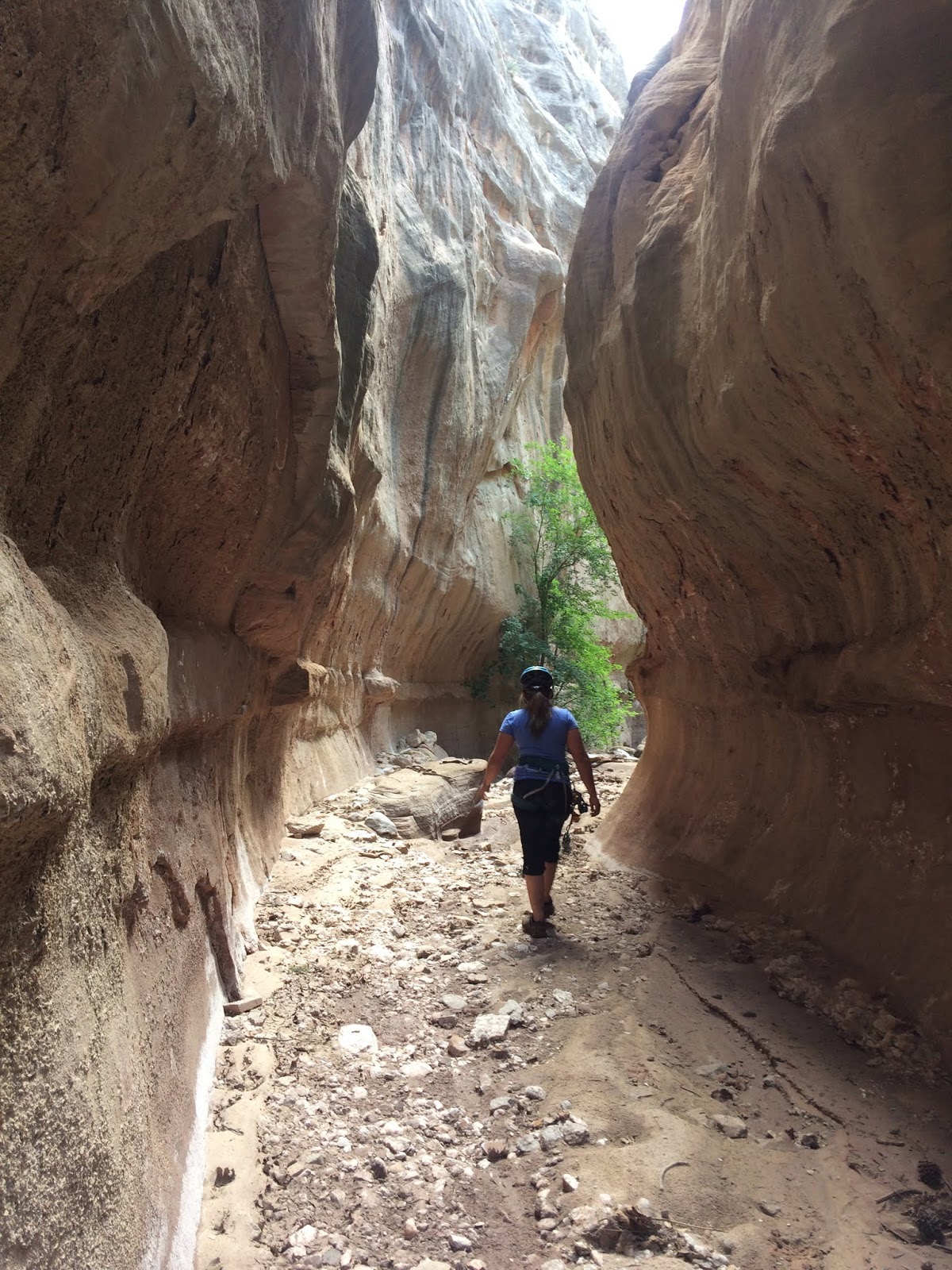
| Narrow walls of alabaster |
For this adventure, I enlisted the partnership of my friend Allie, who in turn invited another friend, Patrick. These two were so invaluable to making the day such a fun experience! Aside from being excellent company, the technical skills and knowledge of our collective group was very comforting.
 |
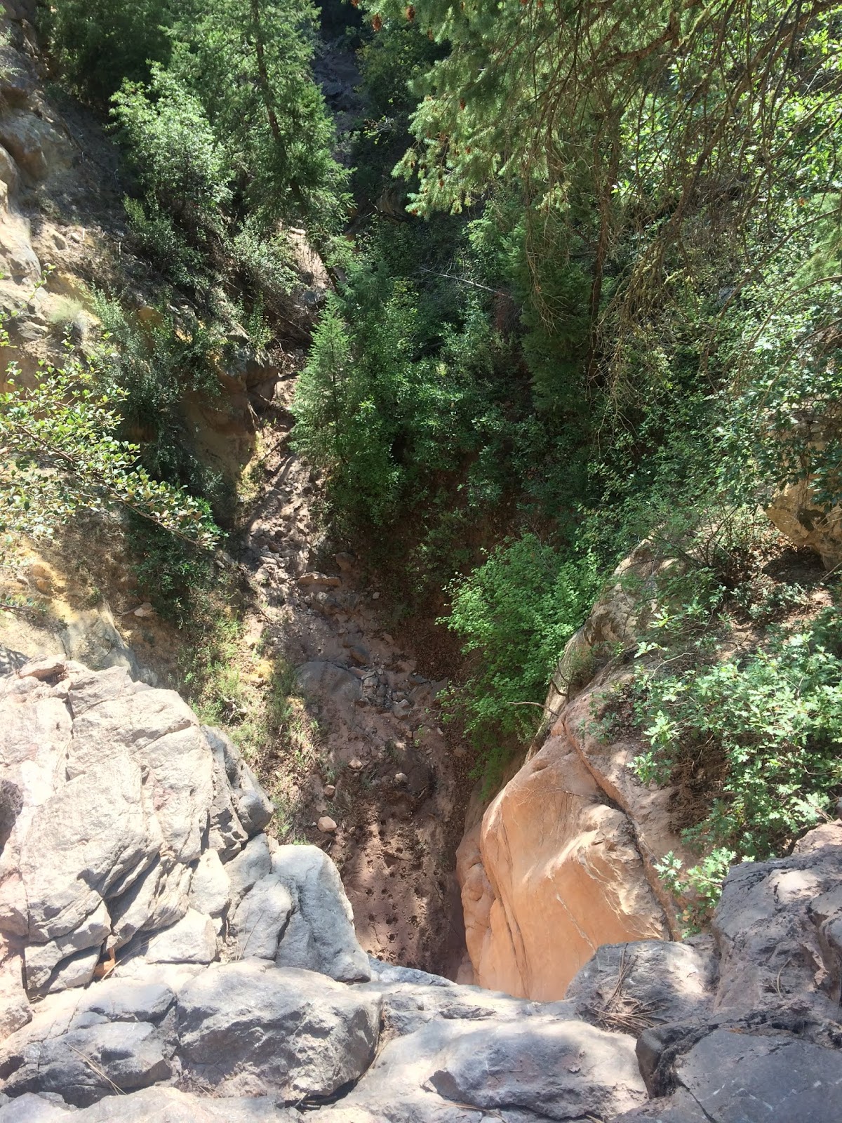
| Peering over the edge of our first rappel, note all the elk tracks in the mud |
We got a really early start, leaving Albuquerque at 5 am. We reached our parking area off of a jeep road high on French Mesa just after 7:30 am. We quickly departed, heading downhill and into a favorable looking drainage. The drainage quickly deepened, cutting into a thick layer of alabaster which towered over us higher than any alabaster canyon I'd been in prior to this one. It was a rather overgrown canyon at this point, which was slightly unexpected. Come to turn out, we had taken the wrong branch into the main canyon, which was very obvious once we connected.
 |
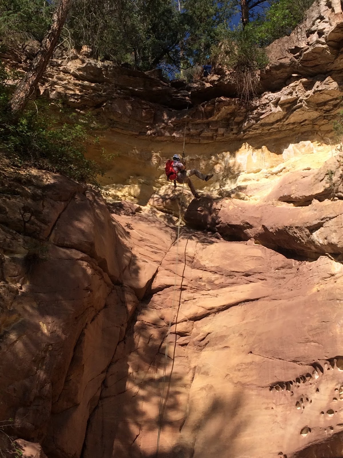
| Patrick heading down the rappel |
The main canyon was much more open! The alabaster walls were very sheer and roughly 100 feet thick in some areas! It was mostly a narrow box, though it would become quite thin in a few places.
We took care on the alabaster downclimbing, as this stuff is not nearly as solid as you'd like it to be. But it was more than manageable and provided fun little challenges.
 |
| Allie on rappel |
We quickly came to the first rappel, which was a little over 45 feet down into some unavoidable mud. There were two existing lengths of webbing attached to two different trees and joined by a large rapide. After inspecting the webbing and feeling confident in its strength, we harnessed up and one by one went over the edge. The smooth sandstone wall just below the grey-rock of the lip was incredibly aesthetic! We were able to land in mud a little more solid off to the side, avoiding the oatmeal mud directly beneath the lip. You could scramble around this rappel and deposit yourself farther down in the canyon via a game trail, but come on, it's way more fun to go down on a rope!
 |
| Patrick within the alabaster canyon |
|
After the rappel, we took off our harnesses and continued heading down canyon, passing two tributaries worthy of exploration on our right. Unfortunately weather moved in later and we were unable to explore those canyons today.
The canyon remained sandstone for a short distance before going back to alabaster. There was one downclimb that proved passable with some chimney maneuvers. I found a handline beneath the overhang just left of the downclimb amid the jumbled boulders, but it appears that debris washed down in a flash flood and rendered the handline unusable.
 |
| Allie and Patrick at the toughest alabaster downclimb. Handline visible in the back of the dark "cave" |
Another downclimb out of the alabaster layer and down into the Entrada Sandstone. While the alabaster canyons were beautiful, the artistic qualities of the water carved sandstone are just indescribably beautiful. Once in the sandstone, the quantity of obstacles quickly increased.
 |
| Transitioning from alabaster canyon to sandstone |
 |
| Patrick providing some perspective |
 |
| Allie getting ready to stem over one of the deeper mudholes |
The first major obstacle was a 12 foot drop that is unable to be downclimbed. At the bottom was a pit of mud. A previously used handline was still present, though I was able to pull it right out of its constriction. I secured the handline to some of my own cordelette on a jammed log. We downclimbed the loops on the handline into the mud and entered a new narrow passage that had tons of mudholes and small/shallow pools.
 |
| Handline descending the 12 foot drop |
The first waterhole was the largest...and most people who know me know I can be rather hydrophobic while hiking, similar to a cat. I'll get wet if I HAVE to, but will avoid it if it's at all possible. So for this particular obstacle (after splashing mud in a futile/naive effort to leave stepping stones), I stemmed out as far as I could go and then made the jump to the other side, one foot sinking in mud and the rest of me getting splashed here and there. But the result? I was mostly dry!
 |
| Looking upstream from one of the small pools below the drop |
 |
| Allie working over the one of the last pools in the corridor via balance |
 |
| Lots of stemming practice in here! |
Allie decided to go with the flow, keep things simple, and just wade through the water, which was probably knee deep. From here, there were two more large puddles, but I was able to get over one with stemming and the other by walking down a log that lay over the water. Patrick was my partner in keeping dry, and Allie gave up trying to stay dry if the effort to do so wasn't worth it.
 |
| Patrick climbing around one of the larger pools |
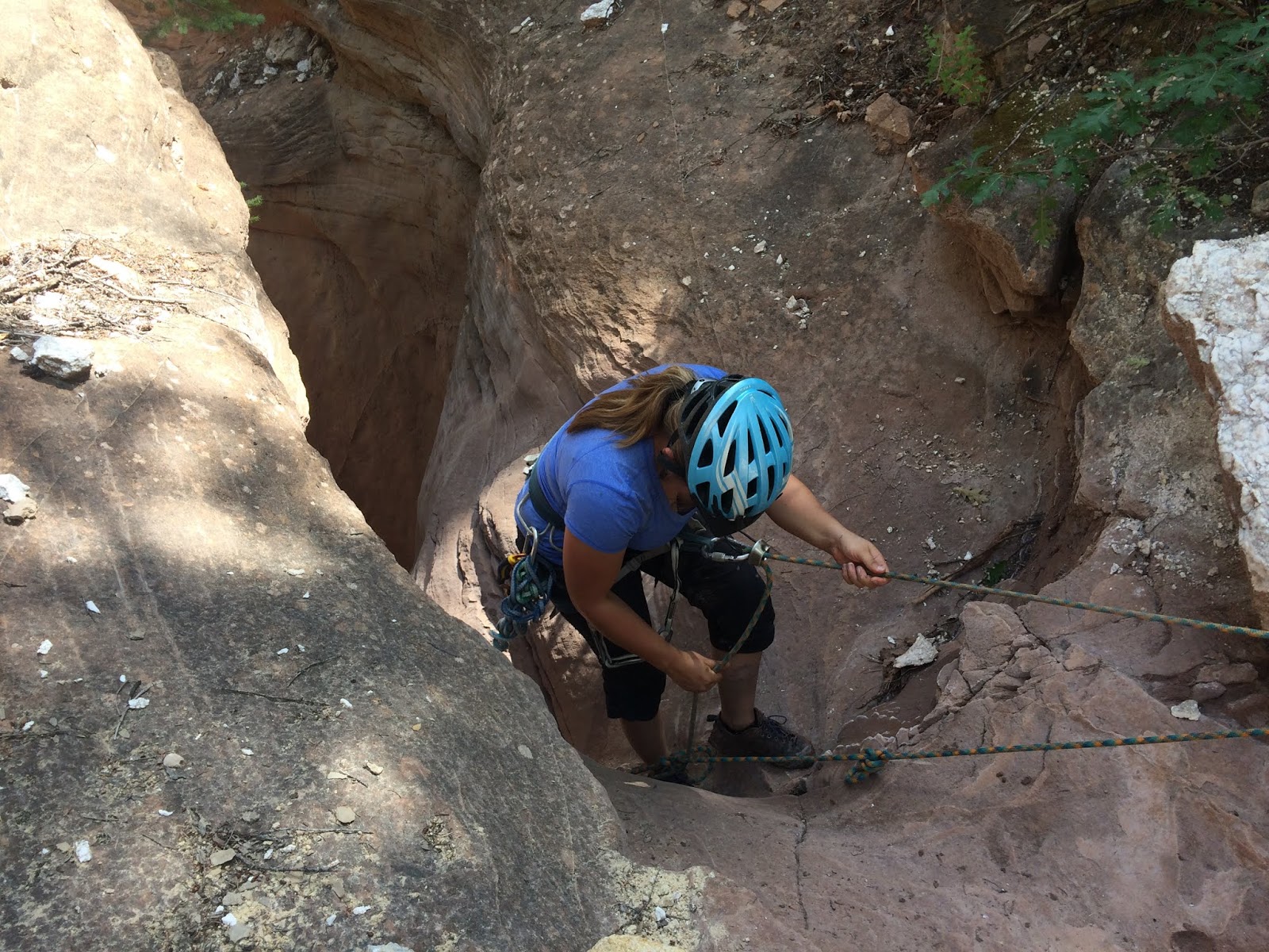
After a little more descending, a few more drops, and one narrow passage deemed worthy of the name "The Bog" (the water in this one unexpectedly claimed Patrick), we arrived at the major crux of the canyon. A 30 foot rappel that dove straight through the sandstone and deposited us into the most consistently narrow and the deepest part of the canyon. Allie and Patrick rappelled down one strand, and I downclimbed on butterfly knots on another strand.
 |
| The drop into the sweet spot! | |
|
 |
| Allie paying the entrance fee to the best part of the canyon |
Down here, the canyon floor was wider than the walls above you in some places. It was beautiful as a dream, and I couldn't help but try to envision the years of water weathering that had taken place to sculpt this masterpiece.
 |
| It's quite different down here :) |
 |
| One of the wider portions in the bottom |
 |
| Looking upstream |
 |
| Allie providing some perspective |
 |
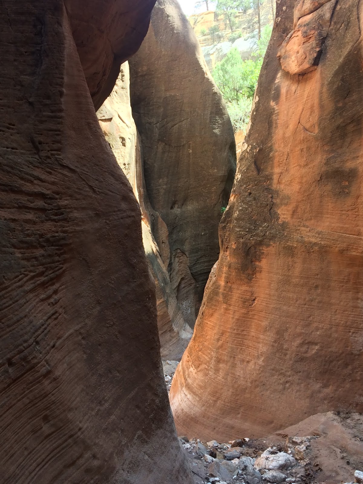
| Now THIS is a great canyon! |
Shortly beyond the rappel, you pass through a section that makes the cover of Doug Scott's "New Mexico Slot Canyons" book, which I recommend if these interest you. I've admired the photos of this spot for years, but the feeling of being within these passages was just one I wasn't quite prepared for. I felt dwarfed within the walls, a feeling I have grown to appreciate. Down here in the lower portions of the canyon, the walls tower almost 300 feet above you!
 |
| Spectacular passage where the bottom is much wider than the walls above |
 |
| Much more sheer walls behind Patrick! |
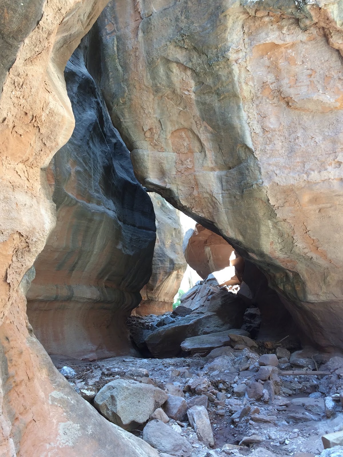
The final crux of the canyon is another mudhole beneath a 10 foot drop with no easy way down. We scrambled around this mudhole and I found a sketchy but do-able downclimb to reenter the bottom of the canyon shortly past this. Allie and Patrick didn't feel okay with doing the scramble, so I continued the short distance to the bottom of the canyon alone, privy to the 25' chockstone wedged in high above you just a few corners and turns away from the scramble.
 |
| Allie scrambling around more mud |
 |
| Passage below the final crux |
Instead of going all the way to the Rio Gallina, I decided to turn around when the canyon began to widen and become more lush again. The best of it was behind me now, and it was time to reascend.
 |
| Massive chockstone | | |
We had left the 30 foot rope and after Allie and Patrick ascended the rope via a combination of ascending devices and hitches, I climbed back up the butterfly knots. Getting back through the wet and muddy corridor below the 12 foot drop proved much easier from this direction, and just as I was untying the knot on my cordellette, the rain drops started to fall. It wasn't long before the rain picked up and I noticed little tiny hail pebbles mixed in. Luckily, it was short lived, and though the flash flood risk is low for this canyon due to the small floodplain, we exited the canyon rather quickly in order to minimize the risk of being caught unexpectedly.
 |
| Patrick and Allie getting ready to reascend |
The rest of the hike was relatively uneventful, just trudging (though that sounds more negative than it was) uphill through the beautiful and mostly open forest. The cracking thunder was like a healing symphony to my ears, keeping my simultaneous ecstasy and bliss at rather high levels.
It was a very successful day, and even more fun than I had anticipated! Aside from the magnificence and grandeur of the canyon, I was lucky to have such go-getter partners who never allowed a dull moment. I had climbed with both Allie and Patrick prior to this, but it was my first hike and adventure with either of them, and it certainly won't be the last.
I have left out many logistical details. If you have noticed in the last few posts, I have shifted a bit from my logistical and informative descriptions to a more romanticized and personal descriptive approach. For anyone who reads these, I'd appreciate input on this.
But lastly, as I always say...don't just take my word on how amazing this canyon is. Grab some gear, arm yourself with the knowledge, and get out and find out for yourself!