 |
| The Thumb is a striking formation, staking its claim in upper La Cueva Canyon |
Where to begin. This is a blog post I have looked forward to doing for a really long time, and now that it is here, the words to describe it (if there really are any) have slipped away. This hike is grand, striking, humbling, beautiful, exhausting, rewarding, dramatic, and a thousand other synonyms for these words and more. This hike marked a major milestone in my Sandia exploration years ago, and it exists now as a somewhat spiritual adventure for me anytime I venture out onto its path. I may be talking rather highly of it, but that is because I truly feel that this is one of the best hikes to do in the area...it is one of my favorites of all time. This hike is the famous 7.5 mile
La Luz Trail.
 |
| The TH for the Tramway trail, which connects to lower La Luz |
There are couple of different ways to do the La Luz trail. It goes all the way to the top tram, which makes loop hikes a possibility: you can, of course, hike the trail up and down for a 15 mile trip; You can take two cars and park one at the tram and another at the La Luz trailhead, and you can either take the tram up and hike down ($12 one way), or hike up and take the tram down; and lastly you can use the 2.5 mile Tramway Trail to connect the lower tram to the lower section of La Luz and then take the tram back down, or take the tram up and do the same hike in reverse.
 |
| Good morning, Albuquerque from the Tram Trail! |
To reach the La Luz parking lot, take Tramway Blvd. (east from I-25, north from I-40) to Forest Service Rd. 333, which is at the only major curve on tramway. Travel along this Forest Service road and follow the PAVEMENT all the way to the end, following signs to La Luz parking lot. Near the end the road goes straight but changes to dirt, do not go onto the dirt road, turn right and follow the paved road all the way back to the parking lot. There is a $3 fee to park here.
To reach the Tram parking lot, take Tramway Blvd. to the only stop sign along its length at Tramway Road, turning onto Tramway Road and following it to the parking lot at the lower Tram Terminal. There is a $1 parking fee at this lot.
 |
| Looking up to the hill just north of Tower 1 |
When doing this hike solo, it's best to use the Tramway Trail to connect the tram terminal with the La Luz Trail. If you are with at least one other person and have another car, you can park one at each trailhead and shuttle instead of hiking the additional 2.5 miles. I did this hike solo, starting on the Tramway Trail. This is exposed hiking in the foothills, and it is uphill, so it is best to start with this trail, and the earlier in the day the better. I got out here to begin my hike at 6:30 am, with just enough time to get to La Luz before the sun started shining on me!
 |
| Looking east from the Tram Trail |
The tramway trail is consistent its entire length, traveling through typical foothills terrain the whole way. It's a pretty steady hike until you get about a mile or so from the end. That last mile gets more and more uphill (this is why I avoid doing this part of the trail last, and doing it in the sun), taking you up to meet with La Luz. Though the Tram Trail is dull in comparison to La Luz, it provides gorgeous views east as it passes by Rozamiento Canyon and La Cueva Canyon and the ridges in between.
 |
| Foundation of CCC Cabin just west of the Tram Trail |
The Tram trail connects about a mile up the La Luz Trail. By this point the terrain is already starting to change, with more evergreens and starting to sprinkle onto the landscape. For those who are somewhat out of shape, like myself, this is an excellent spot to take a break, rehydrate, and possibly refuel. You'll need your energy for all of the switchbacks that lie ahead of you!
 |
| Those rocks peeking up are near where the trail goes! |
The lower part of the La Luz trail is pretty, but still no different than many of the neighboring trails on this side of the Sandias. However, it does provide you with excellent views of Albuquerque, Rincon Ridge, lower Juan Tabo Canyon, and far off formations like the west-side Volcanoes and Mount Taylor. The trail travels through high desert terrain, following multiple switchbacks up the steep hillsides to moderate the intensity.
 |
| Looking at La Cueva Canyon rock formations |
Just after 2 miles, the trail ceases the apparently never-ending switchbacks, heading east for a brief moment toward Chimney Canyon. There is a sharp curve at Chimney Canyon that is significant (at least to me) for two reasons. First, it marks western terminus of the highly adventurous Chimney Canyon trail, which goes pretty much straight up the mountainside from here. Second, at this sharp curve, there is a small stream that flows down from Chimney Canyon, providing a brief moment of lush vegetation. Down below the trail is a small, shaded spot right next to the stream...a perfect spot for a break! The stream flows below you here down small dropoff, which can be heard from the trail nearby in heavy years.
 |
| The sun has finally come up, and it is beautifully lighting the landscape! |
After leaving Chimney Canyon, the trail starts winding up again, passing around a large rock formation from which you can gain spectacular views down into La Cueva Canyon! I love to stroll over to this rock peninsula and just soak it all in. Below you is the incredibly rock La Cueva Canyon, and just east inside the canyon is a small section known as the Slot, which is a very narrow section of steep rock. In heavy, wet years you can hear waterfalls flowing below. But, alas, it was quiet on this morning.
 |
| Break spot next to small stream |
 |
| This is where the water flows down below the rest area |
 |
| Looking up into the massive cliffs above Chimney Canyon |
The trail continues on, hugging middle La Cueva Canyon for a moment before darting away once more, following switchbacks of to the side. There are a lot of wildflowers up here in the late summer, and a ton of hummingbirds zipping around from flower to flowers! The switchbacks take you to the bottom of a formation known as The Pulpit...one of the first major formations heading into La Cueva Canyon. You can see a cool, small cave not far up on this cliff face. After a few switchbacks across the rockfall below this formation, the trail heads south to where the magic truly begins.
 |
| Looking toward the Slot in La Cueva Canyon |
 |
| So many colorful wildflowers out at this time of year! |
 |
| Small cave in the face of the Pulpit |
Just over 4 miles up the trail, after passing the Pulpit, you round a corner and wind up at one of the most spectacular, scenic, and powerful views on the Sandias. With towering cliffs above you on the northern side of the Canyon, a ridge heading to a view of Albuquerque to the west, and the most incredible view of the Thumb. The Thumb can be seen from all along this trail, but when you reach this particular spot, it stands so powerfully, dominating the forefront of the canyon here.
 |
| Nearing the Thumb |
 |
| The Thumb standing tall |
 |
| This is a place of dreams |
I could literally sit at this corner spot for hours, just staring up into the canyon and at the various formations. This is where I usually bust out the snacks and drinks, relaxing and letting the world behind me slip away. It's almost a spiritual experience to be here...it is the type of view/spot to make you think about your place in the universe and contemplate the beauty that exists in this world. Or maybe that's just me?
 |
| Southwest face of the Pulpit |
 |
| Formation known as The Frog |
From this scenic point, the travel travels east into the heart of upper La Cueva Canyon. Not far in, you'll pass a sign stating that you are 5 miles into the hike. From here, the trail goes back to it's lovely switchback nature, but this time the switchbacks travel up the rockslides below the Thumb. For the next 1-1.5 miles...you're in big rock country.
 |
| Sign at the bottom of the rockslides |
 |
| Beautiful shaded forest in the bottom of the canyon |
 |
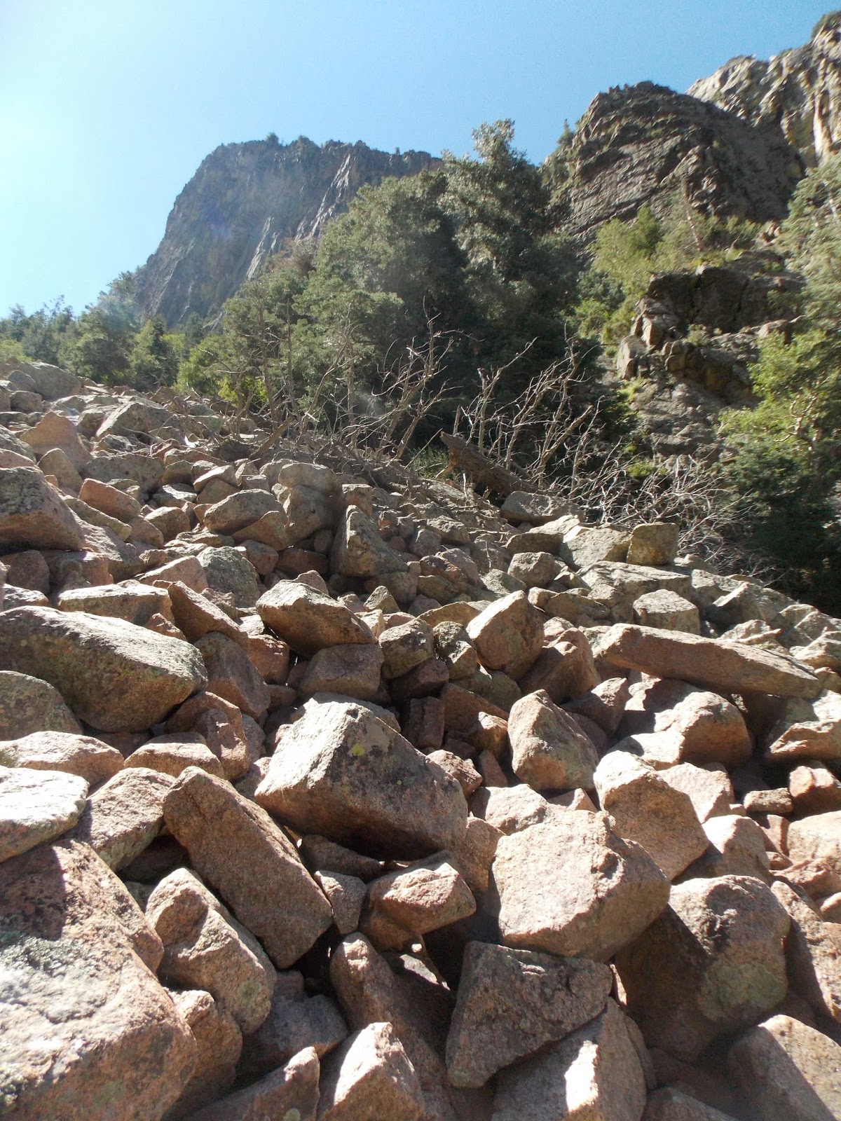
| Looking up at the north/northeast face of the Thumb from the rockslides |
The next mile or so is perhaps the most exhausting stretch of the hike, following the rocky switchbacks up the rockslide (I think there are 15 switchbacks going up!). There are lots of aspens along these slopes, decorating the southern part of the canyon with gold spots in the fall. The footing along this part of the trail is not the best, so watch where you step. The trail is really well defined, it is just very rocky. Throughout this workout, however, you are rewarded with increasingly wonderful views of the towering rock formations in the canyon.
 |
| The Pulpit on the far left, followed by Yataghan, and Torreon finishing out the right side |
 |
| Mexican Breakfast formation |
The views of all of these formations just gets better and better as you get higher, and the trail takes you farther back still into La Cueva Canyon, becoming more forested as you near the limestone bands just below the crest. Just before you reach 6 miles into the hike, the trail departs from the rockslide and travels onto the more welcoming, soft dirt of the forest. Just after 6 miles, you reach the intersection with the Crest Spur trail. This trail takes you to the Crest House. You can take this and then take the crest trail over to the upper Tram Terminal, or you can continue on La Luz for another ~2.5 miles straight to the upper Tram.
 |
| Open skies and green ground along the Crest Spur Trail |
 |
| Looking at the South Sandias from near the intersection |
 |
| More wildflowers along the trail! |
From this intersection, views looking toward the southern Sandias begin to open up. This view is such a drastic change from the rocky slopes in La Cueva Canyon, but it is no less dramatic. As you travel along this stretch of trail, there are points where you can see Kiwanis Cabin on the cliffs above, and incredible views of Echo Canyon and Domingo Baca Canyon below. Traveling along La Luz from here becomes much less of a workout, though the uphill battle is not yet finished.
 |
| Blocky peaks near upper Domingo Baca Canyon |
 |
| Kiwanis Cabin, looking north from near the tram |
 |
| Looking at the La Luz terminus at the Crest |
The La Luz Trail travels up a good, maintained section of trail through the limestone bands to reach the crest. You arrive on the north side of the High Finance restaurant, a great reward if you have the money! I ended my day with another well-deserved snack on the steps by the ski-lift, admiring the views out east before purchasing my tram ticket, and taking it down to the bottom.
 |
| Ski lifts along the green green slopes of the east Sandias! |
This trail is very difficult, with La Luz being 7.5 miles from the bottom to the top, and the described hike from tram to tram being ~9 miles. However, this is by far one of the most scenic and rewarding hikes on the Sandias. There are so many beautiful places to take breaks for those who need frequent ones, and it's just one of those places that really lets you feel just how small you are. This is perhaps the most popular trail on the mountain, and with good reason. Even though you are guaranteed to run into people on parts of the trail, it is mostly the bottom and the top, with the "crowds" thinning out along the middle portion of the trail. I recommend this trail to ANYONE who might be physically fit enough to do it. Even just traveling up partway can be rewarding depending where you turn around.
My words and pictures do no justice whatsoever to this hike. So as I always say, don't just take my word for it...get out and find out for yourself!


No comments:
Post a Comment